PAPER - Although prints can be made of the maps in this collection it is usual to prepare composite shotpoint maps from the digitised versions held in the LOCSEC database.
Type of resources
Topics
Keywords
Contact for the resource
Provided by
Years
Formats
Update frequencies
Scale
-

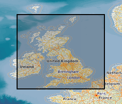
This document data set contains original prints, on paper, sepia or film, of seismic reflection survey location (navigation) maps. These provide the location data for the seismic sections of the Original Seismic Sections (ORIGSEISECS) and Copy Seismic Sections (COPYSEISECS) datasets. Almost all data are within the UK onshore area; although there are some UK near-shore and offshore (North Sea, Irish Sea) and foreign data. Most data were acquired for commercial hydrocarbon exploration and subsequently provided to BGS for use on specific projects. Some data were acquired by BGS and other public-sector bodies, e.g. BIRPS, for academic research. All maps are digitised upon receipt (see LOCSEC database) and then archived in this data set. (Copies used to be used for interpretation purposes but this is no longer the case.) Documents stored rolled in tubes. Approx 800 maps.
 BGS Data Catalogue